At 15 miles this is a long walk, but the rewards come from a rich variety of scenery, far reaching views, a rather special hostelry, and the chance for a swim if you have the energy.
15 miles – but with an easier option.
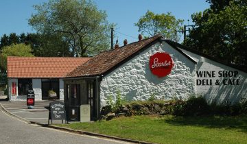
We cheat on this walk and stretch it over two days, staying overnight at The Gurnard’s Head. There we have an excellent dinner and breakfast to fortify our walking legs. It’s not a cheap option, but we think it’s worth it, especially with the weather of the last couple of days.
Unless it has been dry for a week or so expect there to be lots of mud on this walk. It’s certainly one for boots rather than shoes.
From the Market Square in St Just head down the path to the right of the church (worth visiting) which quickly drops you down to New Road and Tregeseal.
Before the houses on the right and the road called The Turnpike take the overgrown looking path. It passes behind the houses and comes out at the stream where you turn right and head up through Tregeseal towards the moors.
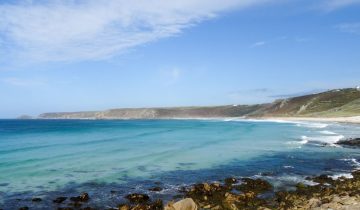
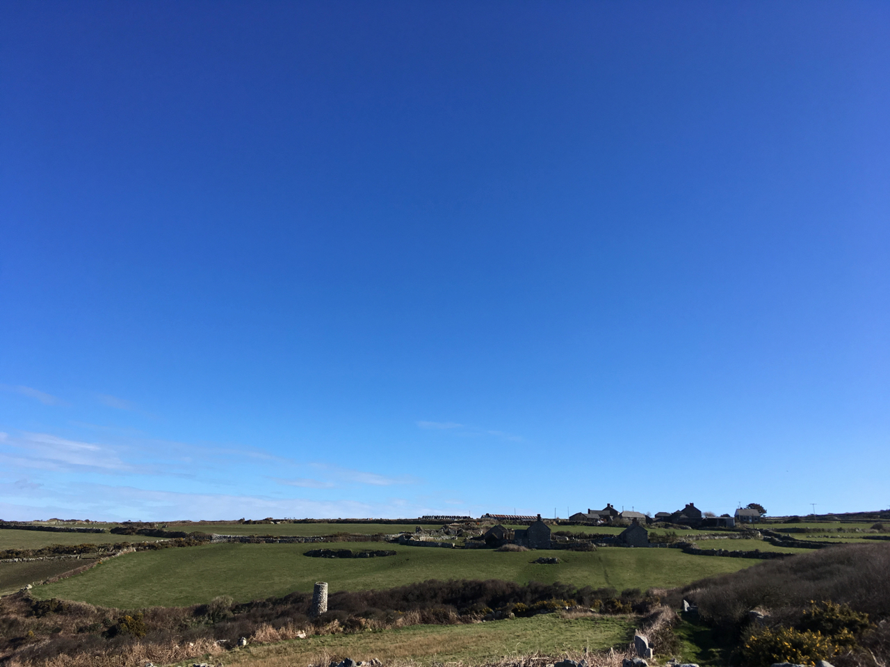
Looking back towards St Just from the track shows you how wonderful its location is, between moorland and sea, often with good views out to the Scilly Isles.
A little after Little Waters farm the track splits. Take the left fork and pass in front of Hailglower Farm. Unless it has been very dry the track is likely to get pretty muddy now.
A stone circle.
Where the track opens up in several directions turn right through the gate and follow the deeply rutted path climbing up onto the carn. On your right you’ll see the Tregeseal Stone Circle. We can only surmise the use of the stone circles, but for a grisly tale read The Legend of Archavon.
Higher on Carn Kenidjack the view gets even better and now includes the north coast around Pendeen. Our path now takes us down hill again as you head for the Woon Gumpus Common parking area. Known locally as The Gump these moorlands are the stuff of legend too, with many stories of the supernatural there. Chances are the stories were invented to deter prying eyes from smuggling operations – but it’s fun to imagine the ghosts that lurked there.
Chün’s burial quoit, and Chûn Castle.
Head for Chûn Quoit, you should be able to see it from the road, although it just looks like a pile of stones. Then from the quoit head on up to Chûn Castle on the brow of the hill. It takes little imagination to picture this hill top fort protecting its inhabitants. The walls were once twenty or more feet high and the well served local folk until the 1950s. On the south side of the fort you can make out remains of ancient roundhouses.
The OS map now shows the path north east as a straight line. It isn’t! It weaves in and out of the furze (gorse) and bracken, but head for the next hilltop at Carn Downs and you should soon find a path with Cornish hedges on either side which will take you north of the shadow site of the ancient Bosullow settlement. It’s easier to make out in winter.
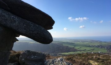
Watch Croft – the best view anywhere (on a good day).
The view from Carn Downs is special – but it’s going to get even better soon. Cross the road just north of Dakota Farm and head for Watch Croft. The sign at the end of the track reads Garden Mine Cottage (or something similar) and the cottage itself has one of the world’s great views on a good day.

Most views of Watch Croft are from the hill, this is looking up towards the cottage.
Watch Croft and Carnmenellis share 4th place in the ranking by height of Cornish hills, both at 252m. The view from Watch Croft is spectacular.
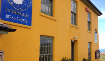
A welcome break, for lunch, or the night.
Drop down to the B3306 road, and if you’re doing the walk in one go you could head straight across and turn left at the cliff path. We walk along to Rosemergy (where you can get a good cream tea in summer) and through the farm to the path that then passes Bosigran climbing club, Bosigran Farm and then Porthmeor before popping out on the road for a final couple of hundred metres before arriving at the welcome sight of the bright yellow Gurnard’s Head Hotel.
Here’s a link to a previous article on this favourite hotel and restaurant. If you can stay then do, or at least have lunch and a well kept ale or two.
Heading west for St Just.
After the longer gradual climbs of the moorland route over the tops you’ll find the coast walk has shorter sharper ascents and descents. The views are just as special, remember to look back as well as forward. There are usually a few seals to be spotted bobbing in the shallows, and if you’re lucky you’ll see gannets, choughs and maybe dolphins.
From the hotel walk west (right out of the hotel) for a few hundred yards until there’s a footpath starting at a stile on your right. Cross a field of Porthmeor Farm with a standing stone (this one isn’t ancient, it’s for the cows’ pleasure), and between Porthmeor Cottages. The path is now pretty clear for most of the route.
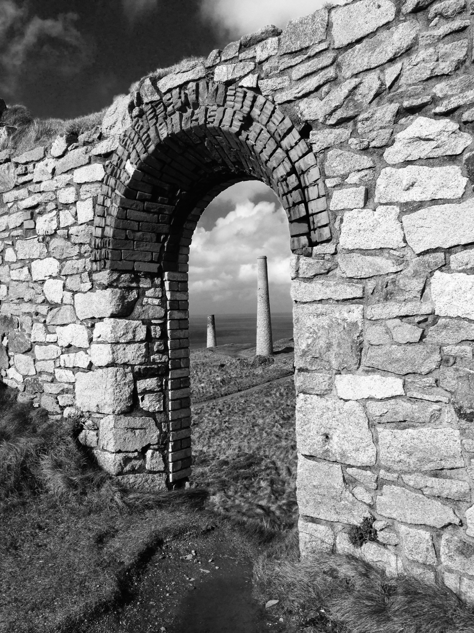
Mine after mine, but each is different.
The mine remains of Porthmeor Stamps have some helpful notices explaining the hard work that went on there. It’s fairly easy to see where each process was carried out at this small site.
Back towards The Gurnard’s, past Porthmeor Stamps.
As you walk up from the mine remains look back to the steeply sloping ribbon fields that run down towards the sea. These are some of the oldest field systems in the world.
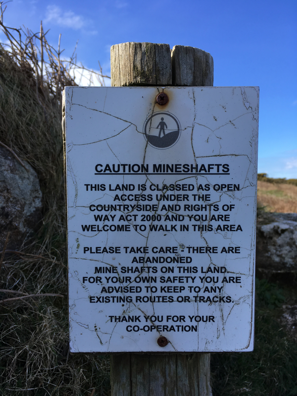
Plenty of open shafts around here – stick to the footpath.
The path soon takes you through the beautiful Bosigran Farm (Bosigran roughly translates as dry place, perhaps because of good drainage) where many of the buildings date from the 17th century. Look out for their lovely organically farmed Belted Galloway cattle in the fields around about.
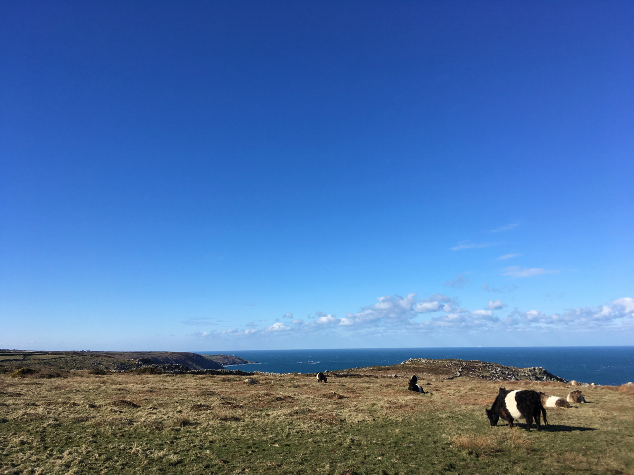
The Bosigran cows, Pendeen Watch in the distance.
The climbing cliff at Bosigran.
As you head towards the climbing club (formerly a mining count house) at Bosigran look up to the mighty Carn Galva dominating the skyline, believed to be the home of the gods by ancient folk. Save the walk up there for another day, you have far enough to go today. We’ve never climbed the cliffs at Bosigran, but we were married on the top.

The Carn Galva mine form below.
Along the cliffs there are footpath signs up to Morvah where there’s a gallery and café that could provide a lunch stop if you have the time.

Imagine building these hedges – by hand!
Two beaches for the price of one.
The next big descent is down to Portheras Beach. This is one of the good locals’ beaches that has no easy driving route to get there. Follow the path just inland behind the beach and dream of the pink house in the field. As I write it is for sale, but at a silly price.
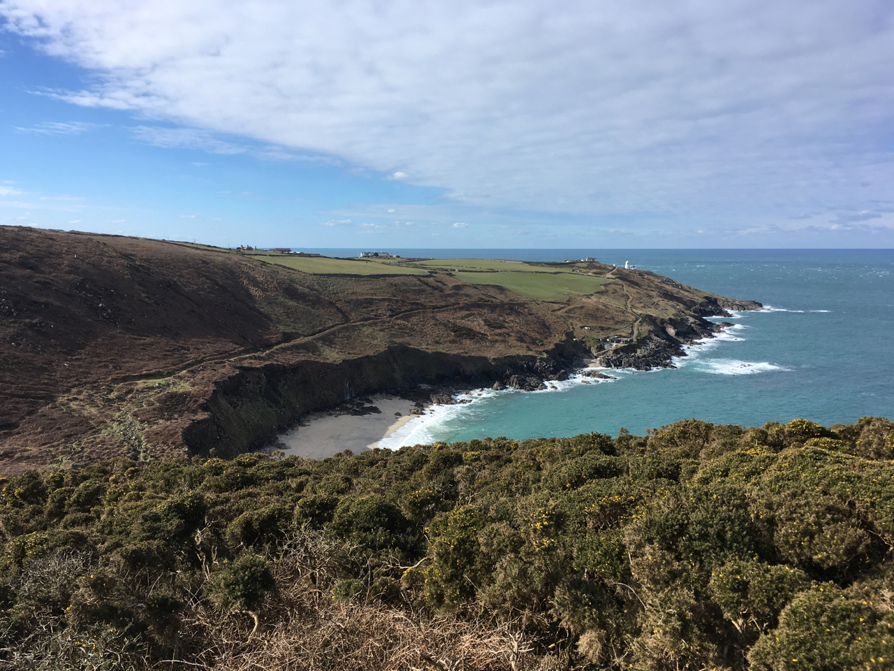
Portheras Beach.
Tiny but pretty Boat Cove follows, and then there’s the mighty Pendeen Watch lighthouse. You can stay in the old keepers’ cottages, but do take into account the massive fog horns on the roof, and the frequency of fog around here!
After the lighthouse you need to walk up the lane towards Pendeen until the path starts again opposite the last of the white coastguard’s cottages. Soon your surroundings change again into the eerie post industrial landscape below the last of our working mines to close, Geevor. There’s a good café there too with a great view and the mine tour is worth going back for.
Post industrial landscape around Geevor.
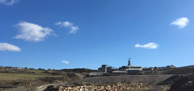
Modern Geevor.
Over the next hill you slip back a century and pass the National Trust’s Levant mine where the oldest working beam engine in the world is still steam powered on many open days.
Above Levant.
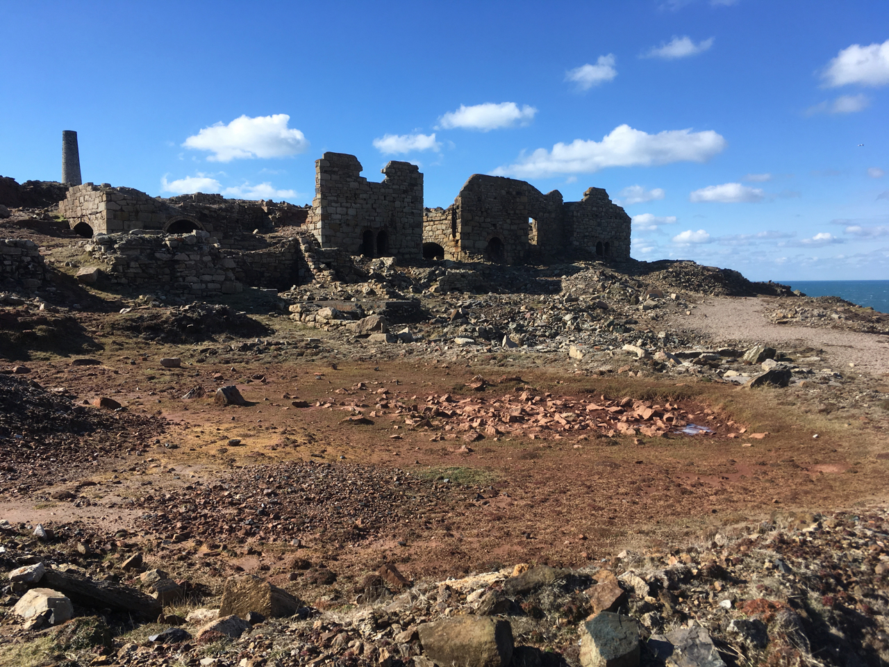
The most dramatic mine remains in Cornwall.
A little further on you pass the remains of the Crown Mines right on the edge below the village of Botallack (the Queens in Botallack is worth a visit for a drink). You have to wonder at the feat of even building these engine houses so close to the edge. The thought of then working there, way out under the sea should be enough to make us grateful no matter how hard our job!
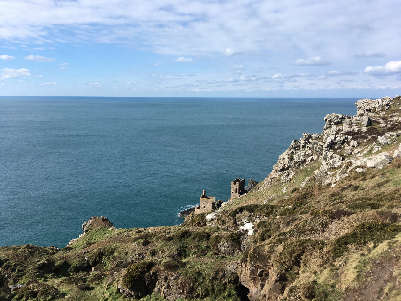
The Crown Mines, below Botallack.
As your legs grow weary the welcome sight of St Just will soon come into view. The track begins to descend and head in land. It’s from there that you’ll get the best view of Cape Cornwall. In the valley pass Polglaze’s log works and then cross the small bridge over the stream (with Poldark eggs for sale on the other side of the road).
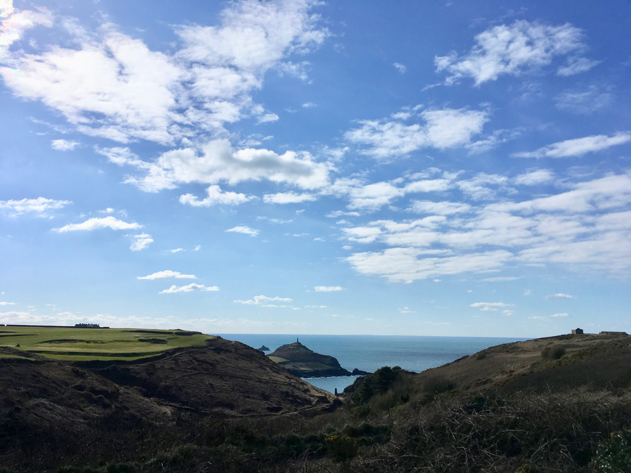
Cape Cornwall – the best view.
The path will soon become a track and then a tarmac lane, you’ll pass the lovely Boscean House, and then Warren’s Bakery, the excellent Old’s Butchers and then you’ll pop up in the town proper.
Feeding tired legs in St Just
There’s good sustenance to be had at The Cook Book Café, sometimes the Dog and Rabbit Café (if it’s open), or the Keg an Teg café. McFadden’s does a good pasty and The King’s is good for a sit down meal.
I hope you’ll enjoy this challenging, but beautiful walk. It takes us about three hours on this route to The Gurnard’s Head, and about four hours back. We don’t rush and we do stop for snacks and photos.
Don’t set off without a decent map, ideally the Around and About St Just, Pendeen and Cape Cornwall which you can buy at the Post Office. It’ll get you almost to the Gurnard’s, but you’ll need the OS Explorer for the last mile or so.