Is it true that all roads lead to St Just?
Who knows, but there’s good reason for them to.
I do my best to help people find the charms of the quaint little town at the end of Britain.
Recently in one of those “if you could live anywhere in the world right now where would you want to be?” type conversations we both said we’d want to be in St Just – but with the caveat that we could afford to break out now and then.
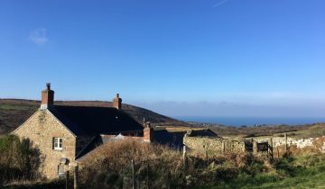
If we were to ask the same question but for a romantic self catering holiday then Tregiffian would take some beating.
So here’s a simple walk to combine the best of both worlds.
It could take a couple of hours, but ideally it’ll take all day.
There’s even an easy route back by bus should you get to St Just and realise that the walk back to Tregiffian is too long.
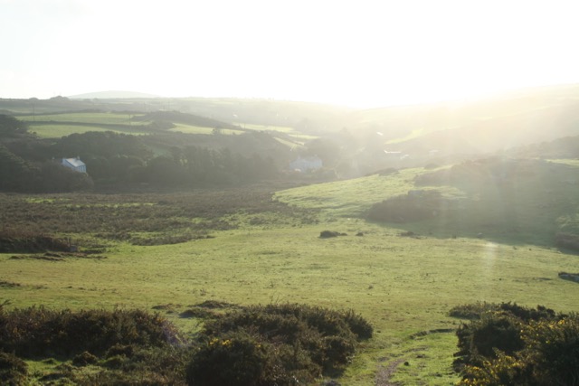
I started early this morning and had the joy of the sun topping the hills as I walked along. The light was stunning and looks good on these photos as full screen images, I hope it translates to the small blog pics too.
Setting off from Tregiffian I walked back down the lane before descending the little tree covered path to the top of Gwenver (just before Peace and Plenty where the parking area is).
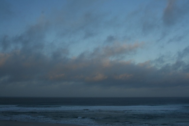
Angry morning cloud on Gwenver.
Gwenver changes all the time as different storms either dump, or steal its sand. Today there are still some sand piles from the storms a few weeks ago, although much of the lower beach has been denuded again.
For her first few years Polly wouldn’t follow me out to Aire Point, but today despite the howling wind and lashing spray from the waves she happily trotted after me. A few minutes later and Gwenver would have been sun bathed.
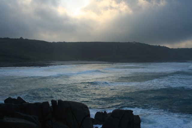
Looking back to Gwenver from Aire Point.
It was about this time that I needed to strip off my jacket and walk in my tee shirt as the south west headed towards a barmy as well as balmy 17° centigrade.
The view from the thinking rock, where Minty and I have made many major decisions.
This stank is all up and down and is tiring despite being only a few miles. From the end of the Nanjulian Valley it’s a climb up to Carn Polpry, then a drop again towards Polpry Cove. You used to be able to get to the shore here, but after many cliff falls it is pretty hairy and I wouldn’t advise it.
Nanquidno from Carn Polpry.
Next is Cran Gribba before the drop to Porth Nanven at the end of Cot Valley.
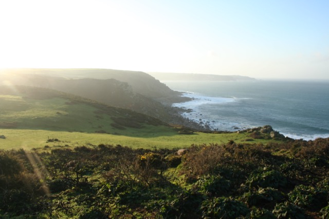
From Carn Polpry towards Lands End.
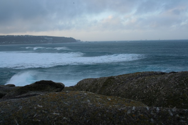
Were it not for the fearsome waves I think a swim would have been essential at this point, but no fool, let alone sane person would venture into waves like today’s unless something needed rescue. From Nanven I headed up Cot Valley to Bosorne and on to St Just, but if you fancied another 25 minutes on the walk then continue to Cape Cornwall, one of the most evocative places I know, and good for an ice cream at the weekend too.
As you walk along remember to look at the cliffside as well as out to sea. You’ll see many adits which look like caves plunging into the rock faces. An adits is a drainage channel from the former mine workings, helping reduce the distance water had to be pumped from underground. You’ll also pass a few neat circular stone walls of a diameter from a couple of metres to far bigger. These surround capped (or sometimes uncapped) mine shafts.
Once you make it to St Just you have many choices including a McFaddens pasty, lunch in the Kings, Cafe Dog and Rabbit, The Cookbook Cafe, Kegn Teg, or just a pint in the Star. There’s also the Commercial and the Wellington, but I don’t know either yet.
Then how do you get home to Tregiffian?
Well the walk is shorter than getting to St Just. It’s 45 minutes at a good lick, or if you get the timing right hop on the Penwith Community bus bound for Lands End. Get off at the Friends Burial Ground (an old Quaker burial ground at the junction where you leave the A30 for the airport road). The buses run every couple of hours, so check out the times before you check out the Star!
Alternatively take the road to Carrallack, heading across country to Trevegean and on towards Gurlands before bearing off for Tregiffian. Don’t try this without a map though. It’s OK when the path is well trodden, but when crops are growing fast the paths can be quickly obscured.

Bosorne and The Brisons from Carrallack Lane.
Today the leg from Tregiffian to St Just took me 1 hour and 40 minutes, including a few photo and stick throwing opportunities. Including Cape Cornwall will take it up above two hours, and the leg back to Tregiffian will probably take you an hour if you have walked that far and then taken on a pasty as ballast.